
1. Monitoring and Prediction of the Water Cycle Variability
3. Understanding River Ecology from the Standpoint of Engineering
|
1. Monitoring and Prediction of the Water Cycle Variability 3. Understanding River Ecology from the Standpoint of Engineering |
|---|
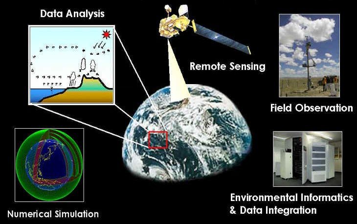
Floods, water pollution and problems such food shortages, and infections caused by water problems are worldwide occurrences, but their effects are particularly grave in developing countries. Together with increasing demands for water, caused by population growth, urban development and expansion of industry, the variability of the water cycle is considered to be one of the reasons for most water related problems. To better cope with the worldwide water crisis, our understanding of the water cycle must be improved and methods for evaluation and prediction need to be developed. Accurate understandings of both the global and local water cycles are indispensable; this requires high-quality data sets at different scales, making it necessary to construct observational networks and to develop satellite based observation techniques. Once available, we can use these comprehensive data sets to study the effects that cause water cycle variations; thus helping to improve prediction capabilities. In cooperation with other national and international institutes, space and meteorological agencies, we are implementing local, regional and global observations to study water cycle variations.
70% of the earth's surface is covered with water. The special characteristics of water are hugely influential; in determining the environmental conditions under which we live. For a better understanding of these, we are investigating and analyzing the variability of the global water cycle and developing numerical prediction models.
The traditional way of water resources management utilizes criteria for planning that are based on past observations. To break away from the limitations of such stochastic methods, we are applying a comprehensive approach that considers the physical processes of the water cycle including spatial (land-atmosphere-ocean) and temporal continuity.
Several tens of tera-bytes of data including in-situ and satellite observations, and model outputs (objective analysis data) are accumulated during the course of a year. For sophisticated utilization of these datasets, a massive archive system along with integrated data analysis methods is necessary. In collaboration with researchers working in information technology (IT) and geographic information systems (GISs), we are trying to establish an information system for the water cycle analysis and prediction.