1. Monitoring and Prediction of the Water Cycle Variability
2. Water Resource Management
3. Understanding River Ecology from the Standpoint of Engineering
|
1. Monitoring and Prediction of the Water Cycle Variability 2. Water Resource Management 3. Understanding River Ecology from the Standpoint of Engineering |
|---|
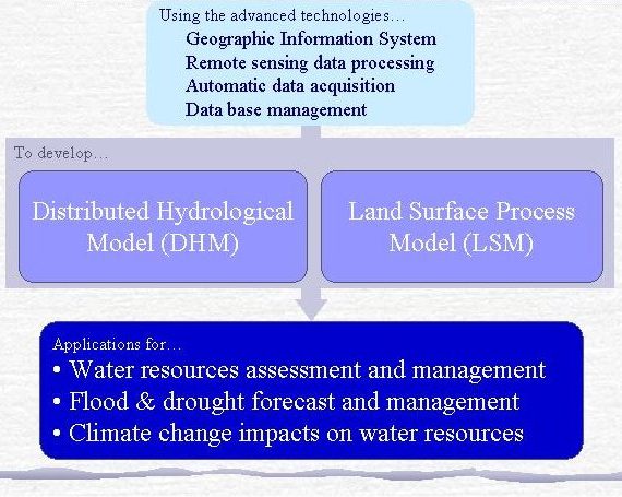
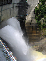
For the proper use of water resources and to protect people from floods, there is a need to apply advanced scientific knowledge and techniques to ascertain a sound basis for decision making. With developments in the earth sciences, it is becoming possible to develop a new generation of hydrological approaches for flood forecasting and water resources assessments. Space based observations of earth and remote sensing techniques provide valuable hydrological information on the spatial variability of the earth. A GIS offers a useful tool for handling the spatial distributed information in an easy and efficient way. To incorporate local contributions due to land cover changes or human activities into the hydrological cycle at basin, region and continent scales, it is necessary to adopt a distributed approach in simulations and predictions involving hydrology. The accuracy of water resource assessment and flood forecasting is also subject to the limitations of meteorological forcing. In addition to the traditional gauge observations, weather radar and atmospheric prediction models provide new possibilities for hydrology, especially for flood forecasts.
High population pressure with its human activities such as agricultural irrigation and dam reservoirs greatly influences the water cycle. Likewise, changes in the water cycle will also alter human water usages. To include both natural hydrological processes and human activities (e.g., irrigation and reservoir operation) in a single system to better understand the water cycle and promote wise management of water resources is a present-day challenge for water resources engineering.
GIS-based distributed modeling, coupling an atmospheric model with a hydrological one, and developing support systems for water resources management are three main topics in this research field.
Aided by a GIS, a watershed can be divided into sub-units; the local hydrological response of each sub-unit is simulated under different topography, land cover, soil property and meteorological conditions, and systematically integrated into the whole watershed response (figure). Modeling approaches with different schemes at different spatial scales should be developed as useful tools for water resources assessments and flood forecasts.
An atmospheric model is the only possible way to provide long-term complete meteorological forcing data to the hydrological model for prediction of future water resources. The hydrological model can in turn help the atmospheric model in respect to land surface parameterization. Coupling the hydrological model with an atmospheric model is an important research topic in both meteorology and hydrology; its achievement will greatly improve the ability to prediction future water resources in near term.
For better managing water resources, the artificial processes of water use and control should be incorporated with natural hydrological processes into a single system; and the implementation of water resources management can then be tested and validated physically and systematically according to societal economic requirements.